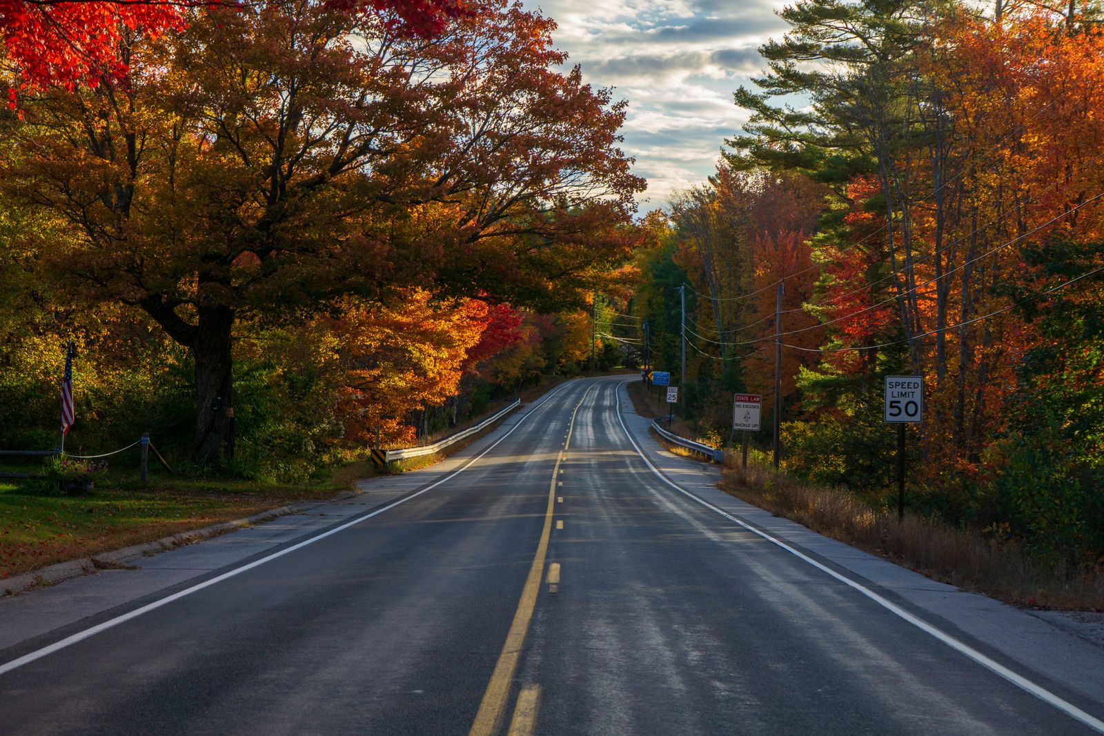
Ici, la voiture est le sujet
Le Vermont compte 251 communes, environ 15 000 km de routes et presque aucun transport public hors de Burlington : la voiture n’est donc pas un compromis, c’est la manière dont l'État est conçu pour être vu. Les routes suivent les rivières et se glissent dans les cols parce que c’est là que le relief le permettait, et le résultat est que le trajet entre deux lieux vaut souvent mieux que l’un ou l’autre.
Cinq itinéraires comptent avant tout : la Route 100 le long de la dorsale de l'État, la Route 108 du col de Smugglers' Notch, la route à péage du mont Equinox, le défilé du Granville Gulf, et la Route 7A à travers le sud-ouest historique. Chacun se fait en une journée, et chacun récompense la lenteur.
Route 100 : toute la dorsale
La Route 100 court sur 348 km de la frontière du Massachusetts à celle du Canada, et elle est largement considérée comme l’une des plus belles routes panoramiques d’Amérique du Nord. Elle ne quitte jamais vraiment les Green Mountains, reliant villages agricoles, villes de ski, moulins à cidre et cascades de bord de route en un seul ruban continu.
Parcourue du nord au sud depuis Stowe, la séquence est presque parfaite : Stowe sous le mont Mansfield, puis Waterbury pour Cold Hollow Cider Mill et l’usine Ben & Jerry’s, puis la vallée de la Mad River par Waitsfield et Warren, puis le Granville Gulf et ses Moss Glen Falls au bord de la route, puis Rochester, Killington et Ludlow, et enfin Weston et Jamaica jusqu'à la frontière du Massachusetts.
N’essayez pas de tout faire en une journée si vous voulez en profiter. Trois jours, avec des nuits à Stowe ou Waterbury, Waitsfield ou Warren, et Ludlow ou Weston, transforment une route en voyage. La moitié du plaisir est de s’arrêter : magasins généraux, stands de ferme en libre-service et trous de baignade sont le véritable contenu de l’itinéraire.
Longueur — 348 km de bout en bout ; 5 heures sans arrêt, 3 jours pour bien faire.
Meilleurs arrêts au nord — Cold Hollow Cider Mill, le Warren Store, Warren Falls, Moss Glen Falls dans le Granville Gulf.
Meilleurs arrêts au sud — le Vermont Country Store à Weston, le Jamaica State Park, le Weston Playhouse.
Saison — pic du feuillage de fin septembre à mi-octobre ; c’est la route la plus photographiée du Vermont et le trafic le reflète.
Route 108 : Smugglers' Notch
Seize kilomètres de la Route 108 entre Stowe et Jeffersonville grimpent à travers Smugglers' Notch, et c’est la plus spectaculaire route courte de Nouvelle-Angleterre. Des falaises de 300 mètres resserrent la chaussée à une seule voie entre des blocs gros comme des maisons, tombés des parois.
Le col tire son nom du commerce clandestin qui y passait pendant l’embargo de Jefferson en 1807, puis de l’alcool remontant du Canada sous la Prohibition. Grottes et fissures y portent encore ces noms.
Deux faits pratiques incontournables. La route ferme au trafic de transit en hiver, environ de novembre à avril, et elle est interdite toute l’année aux camions, autocars et remorques — le lacet du sommet est trop serré, et des véhicules s’y coincent chaque saison. Roulez-la de jour, lentement, vitres ouvertes.
En haut, le parking du col est aussi le départ des sentiers de Sterling Pond et du Long Trail, et Bingham Falls est à cinq minutes côté Stowe.
Longueur — 16 km, 30 minutes sans arrêt.
Fermeture — au trafic de transit en hiver ; interdiction permanente aux camions, autocars et remorques.
Arrêts — départ de Sterling Pond, Bingham Falls, le centre d’accueil de Barnes Camp.
À combiner — la Route 15 vers l’ouest jusqu'à Jeffersonville et Boyden Valley Winery, ou le sud vers Stowe pour The Alchemist.
La Skyline Drive du mont Equinox
La plus haute route à péage goudronnée du Vermont grimpe 8,3 km depuis la Route 7A à Manchester jusqu’au sommet de 1 173 mètres du mont Equinox, point culminant de la chaîne Taconique. Épingles et pentes jusqu'à 12 % passent devant des belvédères sur la vallée de la Battenkill et les Green Mountains.
En haut, le Saint Bruno Viewing Center explique la propriété singulière de la montagne : les moines chartreux de la Charterhouse of the Transfiguration, ordre contemplatif silencieux dont le monastère occupe un flanc, en possèdent l’essentiel et la maintiennent en conservation. Par temps clair, la vue embrasse les Green Mountains, les Adirondacks, les Berkshires et les White Mountains.
La route fonctionne environ de mai à octobre. C’est une route à péage : prévoyez une carte, et comptez une heure et demie aller-retour avec du temps au sommet.
Longueur — 8,3 km à l’aller, environ 1h30 aller-retour avec le centre du sommet.
Saison — environ de mai à octobre ; fermée l’hiver.
À combiner — Hildene, le domaine de Robert Todd Lincoln, et Manchester Center avec ses outlets et la Northshire Bookstore.
Le Granville Gulf et le corridor de la Route 7A
Le Granville Gulf est une réserve d'État de dix kilomètres sur la Route 100 au sud de Warren, où la chaussée est prise entre des falaises boisées et les méandres de la White River. C’est l’un des rares endroits du Vermont où la route elle-même ressemble à un canyon. Moss Glen Falls tombe de 24 mètres juste à côté du bitume — il y a une petite aire d’arrêt, et vous êtes au pied en trente secondes. La gorge reste fraîche au plus chaud de l'été.
Dans le sud-ouest, la Route 7A est l’alternative lente et belle à la Route 7 entre Bennington et Manchester. Trottoirs de marbre, auberges en clin blanc, l’Equinox, et des bifurcations vers l’ouest jusqu'à Arlington et son pont couvert de West Arlington. Ajoutez les dix minutes vers le nord par la Route 30 jusqu'à Dorset pour la carrière de marbre où l’on se baigne et le Dorset Union Store de 1816.
Deux autres méritent le détour : la route du lac Willoughby, la Route 5A, qui passe entre des falaises de 300 mètres des deux côtés d’un fjord glaciaire dans le Northeast Kingdom ; et la Route 108 au nord de Jeffersonville vers la vallée de la Missisquoi, pour ses ponts couverts et ses routes quasi désertes.
Granville Gulf — 10 km sur la Route 100 ; Moss Glen Falls est en bord de route avec une petite aire d’arrêt.
Route 7A — Bennington à Manchester, 30 minutes en prenant son temps ; ajoutez Arlington et Dorset.
Route 5A — la rive est du lac Willoughby, falaises des deux côtés, dans le Northeast Kingdom.
Saison — les quatre sont au mieux de fin mai à octobre ; la Route 5A est spectaculaire début octobre.
Notes pratiques de conduite
Quelques points surprennent les primo-visiteurs. Le Vermont compte des milliers de kilomètres de routes communales en terre, et votre application de navigation vous y enverra sans avertissement — elles sont généralement bonnes en été et vraiment impraticables pendant la saison de boue d’avril et mai. Ne tentez jamais une route de Class-4 avec une voiture de location.
Carburant et nourriture se raréfient vite hors des corridors. Dans le Northeast Kingdom et sur les sections hautes de la Route 100, faites le plein quand vous voyez une station plutôt que quand vous en avez besoin, et attendez-vous à des magasins généraux qui ferment tôt. La couverture mobile disparaît complètement dans les vallées et les cols : téléchargez des cartes hors ligne.
La faune est un vrai danger à l’aube et au crépuscule, surtout les élans dans le Northeast Kingdom et les cerfs partout. Ralentissez dans les sections boisées pendant la première et la dernière heure de lumière.
Et l’hiver, les pneus neige ne sont pas optionnels si vous comptez rouler en montagne. Plusieurs des plus belles routes — le péage de l’Equinox, la traversée de Smugglers' Notch — ferment tout simplement.
Comparez les prix en direct pour une nuit à chaque extrémité de la route dans la recherche ci-dessous, avec annulation gratuite sur la plupart des chambres.
Bon à savoir
Questions fréquentes
Quelle est la plus belle route panoramique du Vermont ?
La Route 100, qui parcourt 348 km le long de la dorsale de l'État devant villes de ski, moulins à cidre, ponts couverts et cascades de bord de route. Cinq heures sans arrêt, mais trois jours avec des nuits à Stowe, Waitsfield et Ludlow en font un vrai voyage.
Peut-on traverser Smugglers' Notch en voiture ?
En saison, oui — la Route 108 grimpe seize kilomètres entre Stowe et Jeffersonville par des passages à une voie entre des blocs tombés. Elle ferme au trafic de transit environ de novembre à avril, et camions, autocars et remorques sont interdits toute l’année car le lacet du sommet est trop serré.
La Skyline Drive du mont Equinox vaut-elle le détour ?
Oui. 8,3 km de route à péage goudronnée depuis la Route 7A jusqu’au sommet de 1 173 mètres, avec des pentes jusqu'à 12 %, un centre d’accueil au sommet qui explique le monastère chartreux propriétaire de la montagne, et une vue sur quatre États. Ouverte environ de mai à octobre.
Où se trouvent les Moss Glen Falls de la Route 100 ?
Dans la réserve d'État du Granville Gulf, sur la Route 100 au sud de Warren — une chute de 24 mètres juste au bord de la route, avec une petite aire d’arrêt, à trente secondes de marche de la voiture.
Faut-il se méfier des routes en terre du Vermont ?
Oui. Les applications de navigation y envoient sans avertissement. Elles sont généralement bonnes en été mais impraticables pendant la saison de boue d’avril et mai, et une route de Class-4 ne doit jamais être tentée avec une location. Téléchargez des cartes hors ligne : le réseau tombe dans les vallées.
Chaque réservation via Vermont Destinations finance une tonne vérifiée de CO₂ retirée — même chambre, même prix, sans majoration.
Trouver un séjour