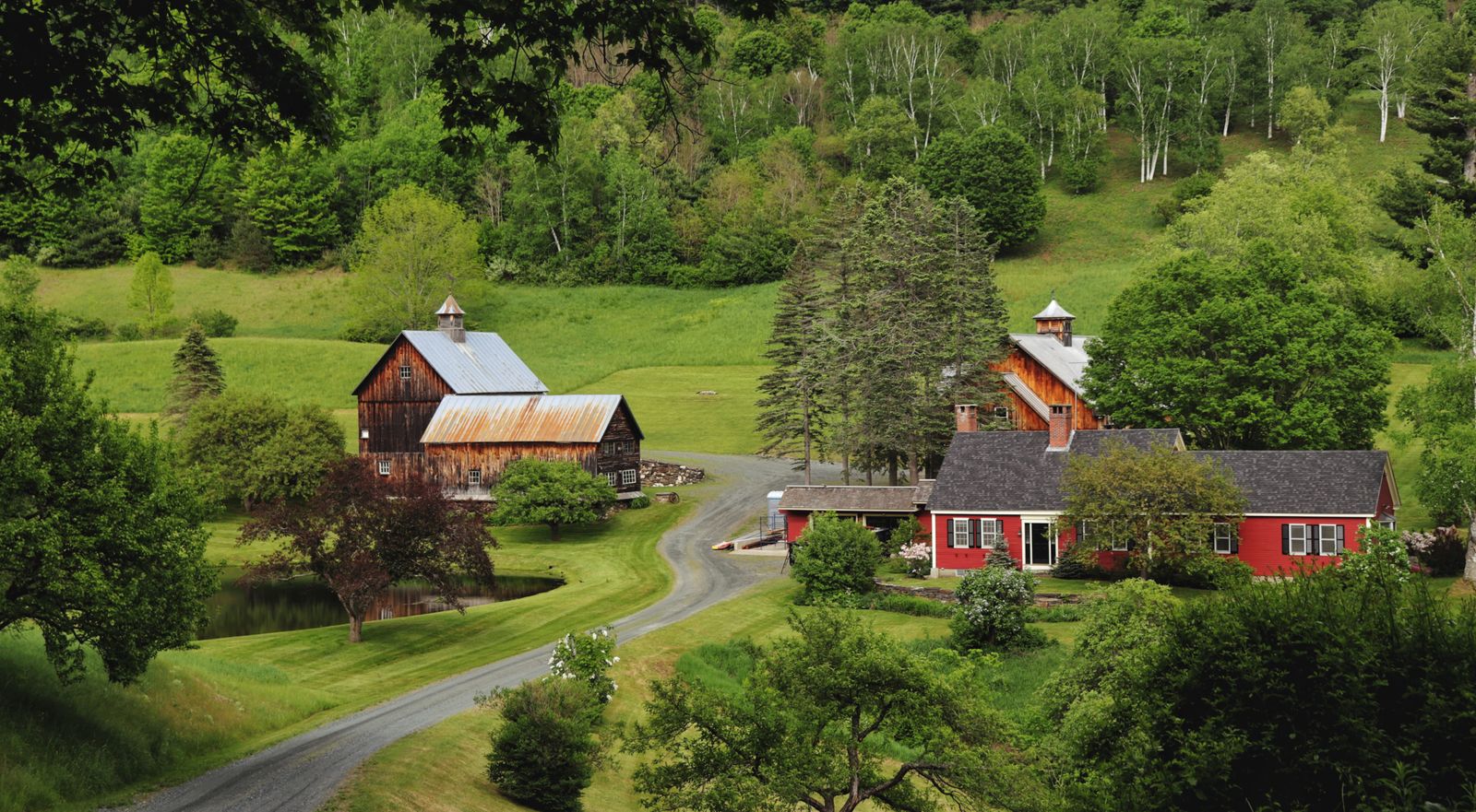
A working river valley
Tucked against the Canadian border in northwestern Vermont lies a quiet, pastoral river valley that captures the working soul of the Green Mountain State. The Missisquoi Valley — stretching from the foothills of Jay Peak in Richford westward down to Lake Champlain — is a landscape of rolling dairy pastures, historic timber bridges, rushing river rapids and vast wetland deltas.
Connecting the corridor is the Missisquoi Valley Rail Trail, a 26.4-mile crushed-limestone path built on the 1870s bed of the Central Vermont Railroad. Descending at a gentle 3 percent grade, it lets cyclists, runners and cross-country skiers pass active red dairy barns, cornfields and quiet riverbends without competing with highway traffic.
Where the rail trail ends in Swanton, the water adventure begins. Here the Missisquoi slows and spills into the Missisquoi National Wildlife Refuge, a 6,700-acre haven of silver maple floodplain forest, wild rice marshes and labyrinthine channels protected for migratory waterfowl, great blue herons and river otters.
Route overview
Four segments, two modes.
Richford to Enosburg Falls — 10.1 miles. Jay Peak vistas, the Trout River confluence and dairy pastures on smooth crushed limestone, descending at 3 percent. Best for scenic gravel cycling and family rides.
Enosburg Falls to Sheldon — 6.5 miles. Dairy-capital hubs, a historic covered bridge nearby and river views on fine gravel. Best for bakery stops and history.
Sheldon to Swanton — 9.8 miles. Open agricultural valleys, iron trestle bridges and a town green finish on flat crushed limestone. Best for easy distance cycling and birdwatching.
Missisquoi National Wildlife Refuge — 5 to 12 miles by kayak or canoe. Dead Creek, Black Creek, Louie’s Landing and heron rookeries on slow delta channels. Best for flatwater paddling and wildlife photography.
Richford to Enosburg Falls
Starting at the eastern trailhead in Richford, a quarter-mile from the Canadian border crossing, the trail begins in the shadow of the northern Green Mountains, with views of Jay Peak’s jagged summit behind you as you pedal west.
This section cuts straight through working dairy farms — black-and-white Holsteins grazing open pastures, historic wooden silos and timber barns that have operated since the late 1800s.
Near East Berkshire the trail crosses the Trout River, a primary tributary known for cold-water trout fishing and historic covered bridges; the Hopkins Covered Bridge is a short half-mile detour off the trail.
Enosburg Falls to Swanton
Arriving in Enosburg Falls you reach the trail’s mid-point hub. Long known as the dairy capital of Vermont, Enosburg was historically home to major creameries and patent-medicine manufacturers, and it offers ideal pit stops — deli sandwiches, cider donuts and local maple ice cream near the trail access.
Continuing west toward Sheldon, the trail crosses the site where two major historic rail lines intersected. Look for interpretive markers on 19th-century railway history and the mineral spring resorts that once drew wealthy tourists to Sheldon Springs.
The final western leg flattens into the lowlands of the Lake Champlain basin, and the valley opens into big-sky views over cornfields, hay fields and freshwater marshes. Near Swanton the trail crosses a massive steel truss railroad bridge over the Missisquoi River, then terminates in the heart of historic Swanton at its Victorian town green, complete with gazebo and a marble swan monument.
Paddling the delta
Where the Missisquoi meets Lake Champlain it splits into slow-moving distributaries, creating one of the most ecologically significant wetland complexes in the northeastern United States. Established in 1943, the refuge protects over 6,700 acres of floodplain, wild rice beds and buttonbush swamp.
Louie’s Landing, right on Route 78 about 2.5 miles west of Swanton, provides a concrete boat ramp and kayak launch onto the main stem of the river. From there, a 5 to 8 mile circuit turns off into Black Creek or Dead Creek — narrow, winding channels cutting through dense silver maple swamps where branches arch overhead into a green canopy.
This sheltered wetland holds Vermont’s largest nesting colony of great blue herons, with over 300 nests on nearby Shad Island, and paddlers frequently encounter osprey, bald eagles, wood ducks, painted turtles and river otters. In late summer the shallow bays fill with tall stands of native wild rice, drawing thousands of migrating black ducks and mallards.
If you would rather stay on foot, the Refuge Visitor Center on Tabor Road accesses the Stephen J. Young Marsh Trail, a 1.2-mile gravel loop with elevated boardwalks and timber observation blinds over managed wetland impoundments.
Four seasons in the valley
A year-round recreation corridor.
Spring, May to June — the river rises with snowmelt, creating deep accessible water in the floodplain forests, and thousands of migrating songbirds fill the refuge trees.
Summer, July to August — lush green rail-trail rides; pack plenty of water, then head to the refuge late in the day for cooler sunset paddles among blooming water lilies.
Autumn, September to October — peak season. Hardwoods along the trail turn crimson and gold while thousands of migrating waterfowl rest in the delta.
Winter, December to March — the rail trail converts to Nordic skiing, fat biking and snowshoeing across a quiet agricultural landscape, with ice fishing on the bay.
Logistics and safety
Four practical points.
Choose the right bike — the surface is fine crushed limestone. Road bikes manage dry sections, but hybrids, gravel bikes or mountain bikes with 32mm-plus tires give far better traction and comfort.
Paddling gear — bring your own kayak or canoe or arrange rentals in St. Albans or Swanton. Federal regulations require life jackets on board; wear them in river current.
Sun and bugs — the open agricultural fields and wetland marshes offer little shade and plenty of insects in midsummer. Apply sunscreen and repellent before heading out.
Stay in the corridor — the trail crosses active working farms. Remain within the right-of-way, close gates if instructed, and keep dogs leashed near cattle.
Good to know
Common questions
How long is the Missisquoi Valley Rail Trail?
26.4 miles of crushed limestone from Richford, a quarter-mile from the Canadian border, west to Swanton’s town green. It follows the 1870s Central Vermont Railroad bed and descends at a gentle 3 percent grade.
What bike do I need?
A hybrid, gravel bike or mountain bike with tires 32mm or wider. The surface is fine crushed limestone — thin-tired road bikes can manage dry sections but will struggle for traction and comfort.
Where can I launch a kayak?
Louie’s Landing on Route 78, about 2.5 miles west of Swanton, has a concrete ramp and kayak launch onto the main stem of the Missisquoi. From there, Black Creek and Dead Creek make a 5 to 8 mile circuit through silver maple swamp.
What wildlife will I see in the refuge?
Vermont’s largest great blue heron colony, with over 300 nests on Shad Island, plus osprey, bald eagles, wood ducks, painted turtles and river otters. Late summer wild rice beds draw thousands of migrating black ducks and mallards.
Can I use the rail trail in winter?
Yes. It converts to a multi-use winter corridor popular for Nordic skiing, fat-tire biking and snowshoeing across the quiet agricultural valley, with ice fishing on the bay nearby.
Every booking through Vermont Destinations funds one verified tonne of carbon removal — same room, same price, no markup.
Find a stay