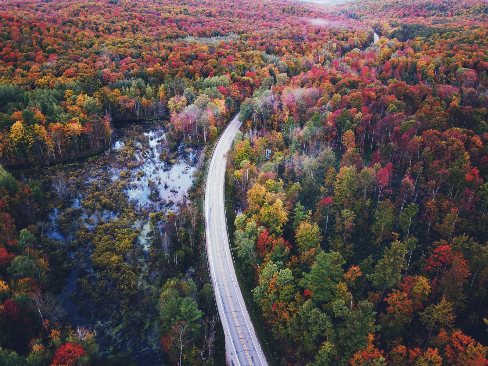
The true pulse of Green Mountain backcountry
The casual visitor knows Vermont through a windscreen. They see the state from paved pull-offs along Route 100: rolling sugar-maple ridges, white church spires nestled into valley basins, manicured dairy pastures framing the horizon. That is Vermont viewed from a polite distance.
To understand the land that is wild at the door, you have to leave the pavement behind. Step past the treeline into a realm where moss carpets the granite, glacial erratics sit like sleeping behemoths among the hemlocks, and the air smells sharply of pine resin, damp soil and subalpine rain.
Vermont’s true wilderness isn’t gated or distant; it begins the instant your boot hits damp earth. Beyond the crowded summits of Mount Mansfield and Camel’s Hump lie secluded routes across forgotten peaks, remote bog loops and ancient granite ridgelines. These five offer genuine wilderness, deep solitude and a direct connection to the land.
Trail 1: Peacham Bog Loop, Groton State Forest
Hidden within the 28,000-acre expanse of Groton State Forest lies Peacham Bog, one of the largest raised peat bogs in Vermont. Formed over 10,000 years ago as glacial ice retreated, this fragile ecosystem feels less like New England and more like the subarctic tundra of northern Canada.
The journey begins along the Coldwater Brook Trail, winding beneath a canopy of mature eastern hemlock, red spruce and yellow birch. As you approach the heart of the bog, the soil beneath your feet turns into a spongy, waterlogged mat of sphagnum moss. A narrow wooden boardwalk carries you across the wetland surface, where the canopy opens to reveal a sun-bleached expanse of stunted black spruce, tamarack and carnivorous pitcher plants tucked into the moss.
The atmosphere is the point: absolute silence. The thick sphagnum acts as an acoustic sponge, dampening wind and birdsong into an eerie stillness.
Distance and grade — 5.9-mile loop, moderate, about 650 feet of gain from the Groton Nature Center.
Flora to watch for — sundew, northern pitcher plant, cotton grass and Labrador tea.
Best window — late September to early October, when the bog turns crimson, copper and amber and the tamaracks drop golden needles across the boardwalk.
Trail 2: Little Deer and Big Deer Mountain traverse
While day-trippers flock to nearby Owls Head for quick overlook photos, serious hikers seek out the raw granite summits of Little Deer and Big Deer. Scoured bare by Pleistocene glaciers, these low-lying domes offer unobstructed views across Lake Groton, Osmore Pond and the distant rolling expanse of the White Mountains in New Hampshire.
The trail starts at a gentle gradient alongside Coldwater Brook before climbing sharply through exposed granite ledges, where roots and glacial drop-offs demand careful footwork. Little Deer’s summit is a perch above Osmore Pond; continuing to Big Deer means a steep dip and climb through spruce-fir forest to a windswept dome at 2,320 feet.
Underfoot it is smooth granite slabs, slick quartz seams and mossy rock staircases. Loons call from Osmore Pond, red squirrels chatter in the firs, and moose tracks often mark the muddy col between the two summits.
Distance and grade — 6.3-mile lollipop loop, moderate to strenuous, about 1,280 feet of gain.
Essential gear — sturdy boots with sticky rubber outsoles for granite traction, plus a windbreaker for the exposed summits.
Trail 3: Devil’s Hill
Devil’s Hill remains one of the Northeast Kingdom’s best-kept secrets. Reached via a labyrinth of gravel town roads and forgotten logging corridors west of South Peacham, this short, steep hike packs an outsized physical and visual punch.
The trail climbs through a dark forest of yellow birch, sugar maple and balsam fir, then ascends steeply along the southern flank of a massive granite cliff face for the final quarter-mile. At the top, open rock bluffs plunge into the canopy below and the view stretches south and west across Peacham Pond, Martin’s Pond and the spine of the Green Mountains.
Look for deep glacial striae on the ledges — parallel scratches gouged into the granite by retreating ice sheets. Mid-October is the moment: the steep drop-off gives you an immersive view looking straight down onto a canopy of red, orange and yellow.
Distance and grade — 1.9 miles round trip, moderate, about 445 feet of gain.
The vibe — isolated and rugged; you will rarely see more than one or two other parties.
Trail 4: Mount Hor via the Herbert Hawkes Trail
Lake Willoughby is often called the Lucerne of America — a 300-foot-deep glacial lake sheared between the cliff faces of Mount Pisgah and Mount Hor. Pisgah draws the crowds; Hor, on the western shore, offers a wilder, quieter trek with equally stunning views.
The Herbert Hawkes Trail climbs through northern hardwood forest dominated by American beech and sugar maple, gaining elevation steadily over soft forest floor before reaching the crest of the ridge. Short spur paths lead to three distinct bluffs — North, East and South Overlook. Standing on the East Overlook ledge, you look down a thousand sheer feet into sapphire water, with Pisgah rising directly opposite.
Wind howling off the lake through the gap creates a steady, ocean-like roar along the cliff edges, and peregrine falcons ride the updrafts against the rock. Keep well back from the edges: the drop-offs are vertical and unprotected.
Distance and grade — 3.6 miles out and back, moderate to advanced, about 1,020 feet of gain.
Note — the cliffs are peregrine nesting habitat; sections may be seasonally closed in spring.
Trail 5: The Long Trail from Sterling Pond to Madonna Peak
Sterling Pond is the highest-elevation alpine body of water in Vermont, perched above 3,000 feet. Starting from the top of narrow, winding Smugglers' Notch on Route 108, this hike follows a rugged section of the Long Trail — America’s oldest long-distance footpath.
The trail ascends steeply from the notch on stone staircases carved into the mountain by the Civilian Conservation Corps in the 1930s. The climb is relentless, winding through dripping hemlock ravines and around giant talus boulders fallen from the cliffs above. At the pond the grade relents, offering a tranquil circuit around pristine alpine water before the final ridge toward Madonna Peak and views down the Green Mountain spine.
Conditions at 3,000 feet shift instantly. A warm 70°F valley day can become a 45°F fog bank on the ridge within the hour.
Distance and grade — 4.2 miles out and back, strenuous, about 1,500 feet of gain.
Terrain — wet stone staircases, exposed roots, high-alpine mud and balsam-scented ridges.
Essential gear for Vermont backcountry
Hiking Vermont’s remote trails safely requires gear built for unpredictable weather and slick, granite-heavy terrain.
Footwear — mid-cut waterproof boots; crucial for mud season, slick granite and wet boardwalks.
Layering — a 200g merino baselayer plus an ultralight rain shell manages moisture on climbs and cuts high-elevation wind chill.
Navigation — topographic paper map and magnetic compass; cell service drops completely in valleys like Groton and Willoughby.
Safety — a compact 300-lumen headlamp and a space blanket; dense canopy goes dark fast once the sun drops behind a ridge.
Traction — lightweight microspikes in early spring and late fall, when black ice forms unexpectedly on high granite ledges.
Leave no trace in the Green Mountains
Vermont’s fragile subalpine environments and peat bogs take decades to recover if damaged. Walk directly through mud puddles rather than widening the trail into surrounding moss. On exposed summits like Big Deer, step only on durable granite. And pack out everything — apple cores and banana peels take years to break down in cold alpine environments.
Rest well afterwards: the whole point of a hard day on granite is the inn at the end of it. Compare live prices in the search below, with free cancellation on most rooms.
Good to know
Common questions
What is the best hidden hike in Vermont?
The Peacham Bog Loop in Groton State Forest — a 5.9-mile moderate loop through one of Vermont’s largest raised peat bogs, with a boardwalk across the sphagnum mat and near-total silence. Best from late September to early October.
Where can you hike above Lake Willoughby without crowds?
Mount Hor via the Herbert Hawkes Trail on the western shore — 3.6 miles out and back with three cliff-edge overlooks. Mount Pisgah opposite takes most of the traffic.
What is Vermont’s highest alpine pond?
Sterling Pond, above 3,000 feet, reached by a strenuous 4.2-mile round trip on the Long Trail from the top of Smugglers' Notch on CCC stone staircases.
What gear do I need for Vermont backcountry hiking?
Mid-cut waterproof boots, a 200g merino baselayer with a rain shell, a paper topographic map and compass since cell service fails in the valleys, a headlamp, and microspikes in early spring and late fall.
Are Vermont’s bogs and alpine summits fragile?
Yes. Peat bogs and subalpine vegetation take decades to recover. Stay on boardwalks, walk through mud rather than around it, and step only on durable granite on exposed summits.
Every booking through Vermont Destinations funds one verified tonne of carbon removal — same room, same price, no markup.
Find a stay